
How to measure elevationUpdated a year ago
Moasure ONE captures three dimensional spaces with ease and allows you to review them on screen.
In this chapter we’re going to show you different ways to calculate elevation changes when using Moasure ONE.
“Point to Point” mode
“Cross Section” tool
Topographical changes
“Point to Point” mode
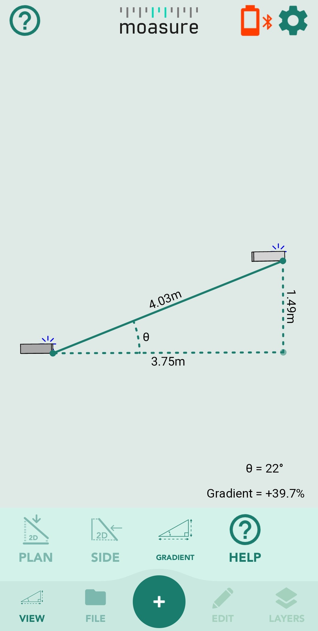
If you’d like to measure the gradient as well as the distance between point A and point B, we recommend using “Point to Point'' mode. Every point you capture will have X, Y and Z co-ordinates, relative to the start point of your measurement.
Please note that you can pause along the way as many times as you need to. The final result will be the distance between the first point and the last point.
Steps:
Press the ‘Start a New Measurement’ button in the bottom centre of the screen;
Select ‘Point to Point’ Mode;
Start your measurement by placing the device on the first point, then quickly walk to the second point.
Result: your measurement will show the linear distance between the start and finish point and the gradient.
Check out this video to learn more.
“Cross Section” tool
The “Cross Section” tool enables you to easily calculate the length, rise and run between point A and point B once your measurement is complete.
This feature can be used with both “Open Shape” and “Closed Shape” modes.
Steps:
Once your measurement is complete, tap on a point of your drawing;
Tap on “View” in the bottom left corner of your screen.
Tap on “Cross Section” in the bottom right corner of your screen;
The point you’ve selected will be highlighted in red. You just need to tap on any other point and the length between those two points, the rise and run will be displayed on the screen.
Feel free to watch this video to learn more.
Topographical changes
With Moasure ONE, measuring up and recording topographical changes is as easy as walking around.
To calculate the elevation changes of a sloped area of grass - effectively like a mini topographical survey - the key is to capture a lot of points in 3D across the terrain.
Check out this example to learn more.